The preservation of cultural heritage has transformed from a passive act of archiving into a dynamic, collaborative ecosystem powered by new technologies.
- Photogrammetry allows anyone to contribute to creating detailed 3D models from simple photographs.
- Digital Twins now serve as living, data-rich blueprints for monitoring sites and planning accurate reconstructions.
Recommendation: Treat your travel photos not just as memories, but as valuable data that can help resurrect history.
The loss of a cultural heritage site, whether to conflict, disaster, or the slow march of time, feels like a permanent tear in the fabric of human history. For generations, we’ve accepted this loss as inevitable. We documented what we could with photographs and drawings, but these were mere echoes of a vibrant past. As a digital archaeologist, I’ve seen this paradigm shift dramatically. The conversation is no longer solely about passive documentation; it’s about active, digital resurrection.
Many discussions about technology in heritage focus on the basics, like using 3D scanners to create a static model. While crucial, this is only the first step. This approach often overlooks the interconnected, living nature of this new field. What if the key isn’t just to scan a monument, but to create a dynamic, collaborative ecosystem where data from millions of sources—including tourists, AI, and advanced sensors—converge to create a persistent digital version of our shared history?
This is the new frontier. We are moving beyond simply creating digital archives and are now building living “Digital Twins” of heritage sites. These are not just viewable artifacts but interactive platforms for research, education, and, most importantly, reconstruction. This article explores the technologies and strategies that form this ecosystem, from turning vacation photos into architectural blueprints to deploying rapid-response scanning teams in high-risk zones. We will uncover how every individual can transition from a passive tourist to an active “Citizen Archaeologist,” contributing to a future where our most precious landmarks can achieve a new form of immortality.
This guide will walk you through the key components of this digital preservation ecosystem. The following sections break down the technologies, challenges, and opportunities that are defining the future of our past.
Table of Contents: A Blueprint for Digital Resurrection
- What is photogrammetry and how does it turn tourist photos into 3D models?
- VR Headset vs. AR App: Which offers a more realistic time-travel experience?
- The “digital dark age” risk: Will our 3D scans still be readable in 100 years?
- How to donate your old vacation photos to help rebuild Notre Dame?
- When to deploy laser scanning teams to at-risk conflict zones?
- What is a Digital Twin and why is it cheaper than physical prototyping?
- How audio beacons assist visually impaired visitors in complex transit hubs?
- How Travelers Can Actively Participate in Protecting Monuments During Visits?
What is photogrammetry and how does it turn tourist photos into 3D models?
Photogrammetry is the foundational technology transforming everyday people into ‘Citizen Archaeologists.’ At its core, it is the science of making measurements from photographs. In digital heritage, this means using specialized software to analyze dozens, hundreds, or even thousands of overlapping photos of a structure. The software identifies common points across the images and uses triangulation to calculate the precise three-dimensional position of those points in space. The result is a dense “point cloud” that forms the geometric skeleton of a highly detailed 3D model.
This process represents a profound democratization of data collection. Before, creating a 3D record of a monument required expensive laser scanning (LiDAR) equipment and specialist teams. Now, the countless photos taken by tourists every day become a potential crowdsourced dataset. Advanced algorithms can stitch together these disparate images, capturing a site’s state at multiple points in time. This is no longer a niche field; 3D reconstruction software holds a commanding share of the preservation technology space, with some platforms accounting for more than 56.21% of the market.
The magic lies in the principle of data symbiosis, where numerous non-professional photos collectively create a dataset often richer than a single, professional scan. Each photo, with its unique angle and lighting, contributes a new piece to the puzzle, enabling the reconstruction of intricate details—from the erosion on a gargoyle to the texture of ancient brickwork. This turns a simple holiday snap into a vital piece of historical evidence.
Your Action Plan: Auditing Photos for Preservation Value
- Identify Sites: List all heritage sites you’ve photographed and note the year you visited.
- Collect Originals: Inventory your archives, prioritizing high-resolution original files (RAW or full-size JPEGs) over compressed social media copies.
- Check Coherence: Cross-reference your photos with key dates of damage or restoration. Photos taken before an event like the 2019 Notre Dame fire are invaluable.
- Assess Detail: Identify images that capture unique architectural features (carvings, windows, structural joints) rather than general scenic shots.
- Plan for Contribution: Prioritize your most detailed, high-resolution, pre-damage photos for potential upload to open-source platforms like OpenHeritage3D.
VR Headset vs. AR App: Which offers a more realistic time-travel experience?
Once a digital model is created, virtual reality (VR) and augmented reality (AR) offer two powerful but fundamentally different ways to experience it. The choice between them depends on the desired level of “temporal realism”—the goal of recreating not just the look but the immersive feeling of a different time. A VR headset offers total immersion. By blocking out the real world, it can transport a user directly inside a fully reconstructed Roman villa or a bustling medieval square, allowing them to walk through spaces that no longer exist.
Augmented reality, typically delivered through a smartphone or glasses, takes the opposite approach: contextual overlay. It superimposes digital information onto the real world. A visitor standing in the ruins of the Colosseum could hold up their phone and see the missing walls and arches digitally restored in their correct location. This connects the digital reconstruction directly to its physical counterpart, enriching the on-site experience by bridging the gap between past and present.
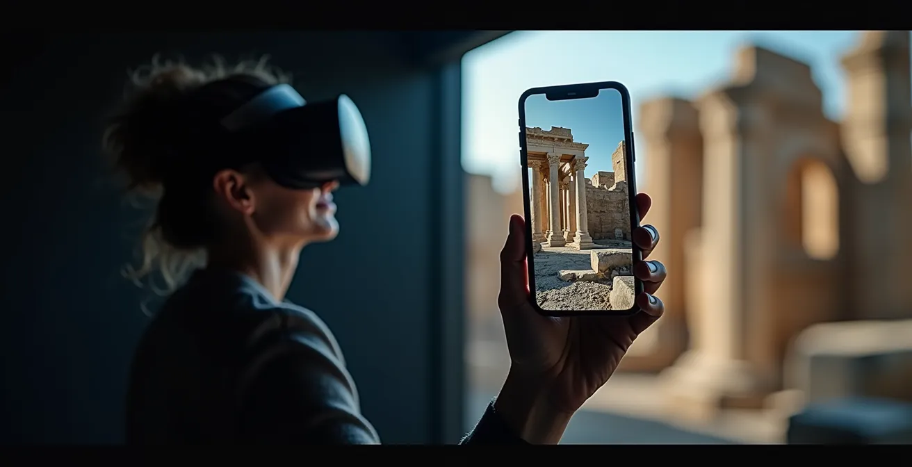
Neither is inherently more “realistic”; they simply serve different purposes. VR excels at resurrecting what is completely lost, while AR excels at enhancing what still remains. The ultimate power of these digital models, however, lies in their ability to guide physical restoration, turning virtual blueprints into tangible reality.
Case Study: Rebuilding Notre Dame
The reconstruction of Notre Dame Cathedral after the 2019 fire is a landmark example of this synergy. As detailed in the NOVA documentary “Rebuilding Notre Dame,” engineers and artisans relied heavily on pre-existing 3D scans and digital models. These virtual blueprints allowed them to precisely fabricate nearly 1,000 new oak beams for the timber framework and guided masons in repairing the collapsed stone vaults with unprecedented accuracy. This case demonstrates how a digital model transcends being a mere visual experience and becomes an essential tool for bringing a monument back to life.
The “digital dark age” risk: Will our 3D scans still be readable in 100 years?
As we accelerate our efforts to digitize global heritage, we face a daunting paradox: the risk of a “digital dark age.” While physical stone can last for millennia, a digital file can become unreadable in a decade due to format obsolescence, media degradation, or the loss of contextual metadata. Creating a 3D model is not the end of the preservation journey; it’s the beginning of a new, ongoing challenge focused on archival longevity. The problem is scaling rapidly; with a projected CAGR of 14.80% through 2032 for the photogrammetry market, we are generating data at an exponential rate.
The core of the issue lies in the fragility of the digital ecosystem. A 3D model is not just a single file; it’s a complex package of geometry data (like .obj or .ply files), texture maps (images), and metadata (location, time, sensor information). If any one of these components is lost or its format becomes obsolete, the entire model can lose its scientific value. Future digital archaeologists might be left with the equivalent of a book in a forgotten language, with no dictionary to translate it.
To combat this, institutions are developing strategies for active, rather than passive, archiving. This includes migrating data to new formats over time, using open-source standards to reduce dependency on proprietary software, and storing multiple copies in geographically diverse locations. The goal is to ensure our digital heritage remains a living, accessible resource for generations to come.
Digital heritage is a computer-based resource of enduring value that should be preserved for future generations
How to donate your old vacation photos to help rebuild Notre Dame?
The call for photos after the Notre Dame fire was a watershed moment, making the concept of the ‘Citizen Archaeologist’ tangible for millions. Contributing your personal photos to a heritage reconstruction project is a powerful way to participate in this global effort. The process isn’t about simply uploading to social media; it requires a more deliberate approach to ensure the images are scientifically useful. The key is to provide high-quality, data-rich source material that photogrammetry software can use effectively.
Preservation projects and university-led initiatives often create dedicated platforms for these contributions. When searching your archives, prioritize the original, high-resolution files from your camera, not the compressed versions saved from Facebook or Instagram. Metadata is just as critical: noting the date, time, and specific location where the photo was taken helps algorithms place it accurately in 3D space. Focus on images that capture specific architectural details—a close-up of a sculpture, the joint of a vaulted ceiling, or the texture of a stone pillar—as these are often more valuable for reconstruction than wide, scenic shots.
This crowdsourced data feeds into sophisticated systems that can piece together shattered histories, sometimes with the help of artificial intelligence.
Case Study: The RePAIR Project in Pompeii
The RePAIR (Reconstructing the Past: Artificial Intelligence and Robotics meet Cultural Heritage) project offers a glimpse into the future of this process. At Pompeii, the system uses robotic arms to scan thousands of fresco fragments. Then, powerful machine learning algorithms analyze the shape, color, and texture of each piece to predict how they originally fit together, guiding the robots to physically reassemble them. A similar logic can be applied to crowdsourced photos, using AI to identify and stitch together architectural details from thousands of different tourist images to form a cohesive whole.
When to deploy laser scanning teams to at-risk conflict zones?
While photogrammetry is excellent for documenting stable sites, heritage in conflict zones or areas facing imminent natural disasters requires a more rapid and precise approach. This is the domain of digital emergency response, where specialist teams are deployed with advanced tools like terrestrial LiDAR (laser scanning) and drones. Deciding when and where to deploy these valuable resources is a critical strategic challenge, governed by rigorous risk assessment, not reactive panic.
Digital archaeologists and preservation bodies use a structured framework to prioritize sites. This involves monitoring geopolitical tensions, climate vulnerability, and structural reports to move a site from a “stable” to an “at-risk” or “imminent threat” status. A site threatened by rising sea levels might trigger a preventive, large-scale laser scanning project over several months. In contrast, a site in a newly established conflict zone demands the immediate deployment of a rapid response team equipped with portable scanners that can capture a detailed record in days or even hours, before access is lost or the structure is destroyed.
This proactive triage ensures that documentation efforts are focused where they are most needed, creating a high-fidelity “digital twin” as a final insurance policy against total loss. The data captured is often the last-ever record of the site in its intact state, making it an irreplaceable blueprint for future study and potential reconstruction.
| Risk Level | Indicators | Documentation Priority | Recommended Technology |
|---|---|---|---|
| Green (Stable) | No immediate threats, regular maintenance | Low – Standard documentation | Annual photogrammetry surveys |
| Yellow (At-Risk) | Climate vulnerability, political tension, neglect | Medium – Preventive scanning | Bi-annual laser scanning + photogrammetry |
| Red (Imminent Threat) | Active conflict, severe weather events, structural instability | Critical – Immediate deployment | Rapid response teams with portable LiDAR, drones |
What is a Digital Twin and why is it cheaper than physical prototyping?
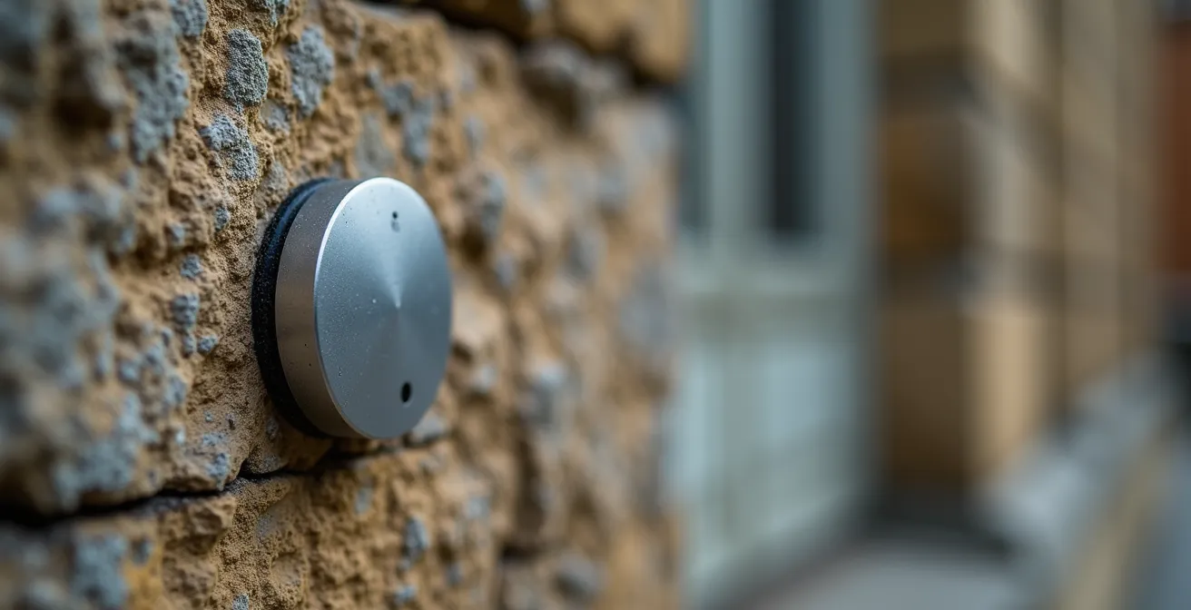
The concept of a “Digital Twin” represents the pinnacle of the digital preservation ecosystem. It is far more than a static 3D model; it is a living, dynamic virtual replica of a physical heritage site, continuously updated with real-world data. This is achieved by embedding sensors on the actual structure—to monitor temperature, humidity, structural strain, or cracks—and feeding this data directly into the virtual model in real time. This creates a feedback loop where the digital version mirrors the current condition of its physical counterpart.
This living quality is what makes it fundamentally different and more powerful than a simple scan. For example, engineers can use the Digital Twin to simulate the impact of an earthquake on a historic building or model the long-term effects of climate change on its facade. This predictive capability allows for proactive conservation, addressing problems before they become catastrophic. It’s also dramatically more cost-effective than physical experimentation. Instead of building costly physical mock-ups to test a new restoration technique, artisans can test it virtually on the Digital Twin an infinite number of times, refining their approach without risk.
The economic benefits are significant. For restoration projects, which often involve unique and irreplaceable materials, the ability to prototype virtually is revolutionary. By testing and validating repairs in the digital realm first, heritage projects can achieve up to a 75% reduction in prototyping costs and minimize waste. The Digital Twin serves as the ultimate blueprint, ensuring that every physical intervention is optimized for success.
How audio beacons assist visually impaired visitors in complex transit hubs?
The technologies powering digital heritage are also revolutionizing accessibility, ensuring that these resurrected histories can be experienced by everyone. For visually impaired visitors, navigating a complex heritage site can be a challenge. Modern systems are moving far beyond simple audio guides by creating multi-sensory, hyper-contextual experiences. This is often achieved by combining low-energy audio beacons with the Ultra-Wideband (UWB) chips found in modern smartphones.
UWB allows for incredibly precise indoor positioning, accurate to within a few centimeters. As a visually impaired visitor moves through a site, their phone can detect exactly which artifact they are approaching. This triggers a highly specific audio description, delivered through their headphones, that is far more detailed and relevant than a generic room-by-room guide. The system can even adapt the narration based on the visitor’s speed and direction of movement, creating a seamless and intuitive navigational flow.
The experience is further enriched by integrating other senses, particularly touch. This is where the digital models created for preservation find another powerful application.
Case Study: Multi-Sensory Accessibility in Museums
Leading museums and heritage sites are now using their 3D scans to create high-fidelity, 3D-printed tactile replicas of key artifacts or architectural features. A visually impaired visitor can listen to a detailed audio description of a statue while simultaneously exploring its form and texture with their hands. This synchronized audio-tactile approach provides a much deeper and more meaningful understanding of the object. It’s a perfect example of how the digital preservation ecosystem not only saves history but also unlocks new ways for everyone to connect with it.
Key Takeaways
- Digital preservation has evolved from static scanning to creating living ‘Digital Twins’ that are continuously updated with real-world data.
- Every traveler can become a ‘Citizen Archaeologist’ by contributing high-quality vacation photos to crowdsourced reconstruction projects.
- The ultimate goal of digital models is not just viewing but guiding accurate, cost-effective physical restoration of our shared heritage.
How Travelers Can Actively Participate in Protecting Monuments During Visits?
The new digital heritage ecosystem empowers every traveler to become a guardian of history. Active participation goes beyond the “leave no trace” principle; it involves consciously using your visit to contribute to a site’s long-term preservation and resilience. The most powerful tool you have is your smartphone’s camera, which can serve as a data-gathering device for the global ‘Citizen Archaeologist’ movement. By taking clear, detailed photos of architectural elements, you are creating potential source material for photogrammetry and future reconstructions.
Furthermore, many organizations are now deploying “citizen scientist” apps that allow tourists to report damage in real time. By submitting a geotagged and timestamped photo of a new crack, graffiti, or signs of deterioration, you provide site managers with invaluable, up-to-the-minute data. This helps them prioritize maintenance and intervene before small problems become major threats. You are no longer just a visitor; you are a distributed sensor in a global monitoring network.
This shift in mindset is the hopeful conclusion of our journey. Technology has not only given us the tools to digitally resurrect our past but has also distributed the responsibility for its protection. By embracing your role as an active participant, you ensure that these monuments are not just preserved as static relics, but are kept alive through a continuous, collaborative effort.
Start today. View your photo archives not just as a collection of memories, but as a potential library of historical data. On your next trip, take those extra few shots of architectural details. You may be capturing the very piece of the puzzle needed to one day bring a piece of history back to life.
Frequently Asked Questions about How New Technologies Are Restoring Destroyed Heritage Sites Digitally?
What photo quality is needed for heritage documentation?
High-resolution images (minimum 12MP) in RAW format with good lighting and multiple angles provide the best data for 3D reconstruction.
Which apps can travelers use for 3D scanning?
Consumer apps like Polycam, Luma AI, and RealityCapture allow smartphone-based 3D scanning that contributes to heritage archives.
How can tourists report damage to heritage sites?
Use citizen scientist reporting tools to submit geotagged, timestamped photos of cracks, graffiti, or deterioration directly to site management systems.